Saint-Raphaël
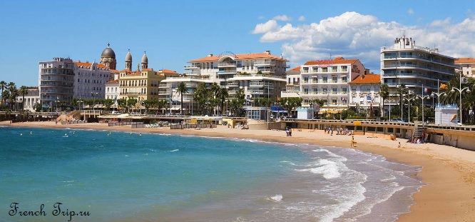
Saint-Raphaël is a seaside town at the western end of the French Riviera, about 40 km from Cannes and 50 km from Nice. With around 33,000 residents it is a manageable size, and considerably cheaper than the resorts further east.
It runs into Fréjus, the older Roman town 3 km inland, and the two form one agglomeration — but each has its own railway station, which is worth knowing when you book.
The town became fashionable in the later nineteenth century under the mayor Félix Martin and the writer Alphonse Karr, who publicised its mild winters. Artists, athletes and politicians followed, and the Belle Époque villas along the front date from then.
Rich Roman families already used the site as a retreat, and the settlement took repeated damage from barbarian raids and Saracen attacks through the Middle Ages before it slipped into obscurity. It resurfaced briefly in 1799, when Napoleon landed at the small harbour on his return from Egypt; fifteen years later the same harbour saw him put aboard ship for exile on Elba, after his fall.
The revival proper began in 1864, when Alphonse Karr, a journalist and former editor of Le Figaro, settled here and talked up its mild winters to friends in Paris. Dumas, Maupassant and Berlioz came on his recommendation, and Charles Gounod wrote his opera Roméo et Juliette here in 1866; its Paris premiere the following year ran to ninety performances over two years.
Most of the belle-époque villas and grand hotels were lost in the Second World War, when the town became a key point in the Allied landings of August 1944; some have since been rebuilt, others replaced with newer buildings. What survived, together with wide beaches and a lower cost of living than its neighbours further east, has made Saint-Raphaël one of the wealthier towns on this stretch of coast while keeping it a family destination rather than a playground for wealthy Parisians.
Getting to Saint-Raphaël
Unusually for a small Riviera town, Saint-Raphaël is easy to reach without a car — which is why it works as a base.
By train
Saint-Raphaël-Valescure station is in the centre, and the bus station is directly behind it. The town is on the main coastal line:
- Cannes — about 25 minutes
- Nice — under an hour
- Marseille — about 1 hour 40
- Fréjus — 3 or 4 minutes
TGV services from Paris also stop here. See trains in France.
By air
Nice Côte d’Azur is the nearest airport, with a direct coach to Saint-Raphaël taking around an hour and a quarter. Marseille is further but often comparable once you add the train.
By boat
From April to early November Les Bateaux de Saint-Raphaël run several sailings a day to Saint-Tropez across the gulf. In summer this is by far the best way to get there — the road round is one lane and jammed.
What to see
The town sits where the red volcanic peaks of the Massif de l’Estérel meet the sea, with the forested hills of the Massif des Maures rising inland to the west.
The old quarter
Behind the seafront: the twelfth-century Romanesque church of San Rafeu, built by the Templars, with a watchtower you can climb, and the archaeological museum beside it holding amphorae recovered from Roman wrecks in the bay.
The church is the third building on the site; excavations beneath it found two earlier Carolingian churches, and a Carolingian crypt survives. The Templar watchtower above one of the chapels was a lookout post, used to spot ships and warn the town when pirates threatened, and the church itself served as a refuge in an attack. Climb it and the view runs the length of the coast, some 22 metres up. Fragments of the Roman aqueduct that once carried water from Fréjus still stand in the churchyard. Oddly for a consecrated building, no mass is said here on Sundays — it is treated as an archaeological monument rather than a working one.
The museum next door holds amphorae, anchors and diving gear recovered from the seabed offshore, along with prehistoric finds from the area. A local legend told of a “lost city” somewhere off the coast; when the diver Jacques Cousteau came to investigate, he found not a city but a Roman merchant ship, sunk with its full cargo of building stone.
Notre-Dame-de-la-Victoire
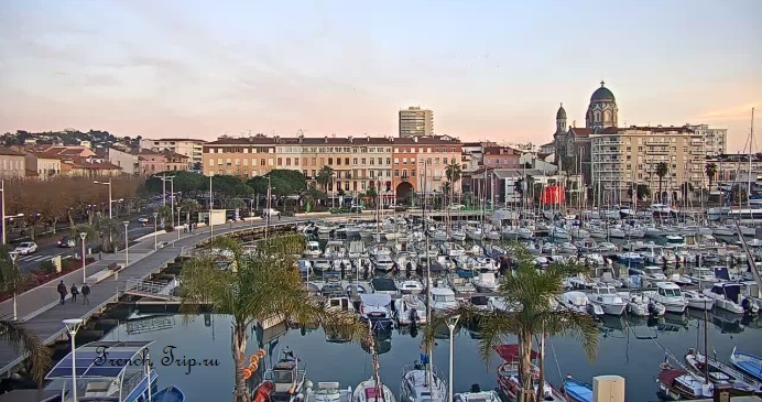
The neo-Byzantine basilica from 1883, with its ochre-and-brick bell tower — the landmark you navigate the town by.
It was built between 1883 and 1887 to a design by Pierre Aublé, paid for out of the boom in seaside tourism the town was enjoying at the time.
The seafront and the port
The Promenade des Bains runs along the Plage du Veillat, the main town beach — sand, not shingle, which is unusual on this coast and one of the reasons families come here rather than to Nice.
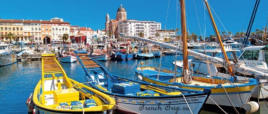
Fishing boats still tie up along the quay at the Old Port, and the catch goes straight to a fish market there each morning. Nearby, the Jardin Bonaparte — a public garden of some 20,000 square metres — looks out over the bay past a statue of the archangel Raphael, with a square and a children’s playground at its centre. A pyramid near the Old Port marks the spot where Napoleon came ashore in 1799. East along the coast, Port Santa Lucia is a working marina ringed with bars and restaurants, and the coastal footpath towards the Estérel starts from its far end.
Walking routes through the town
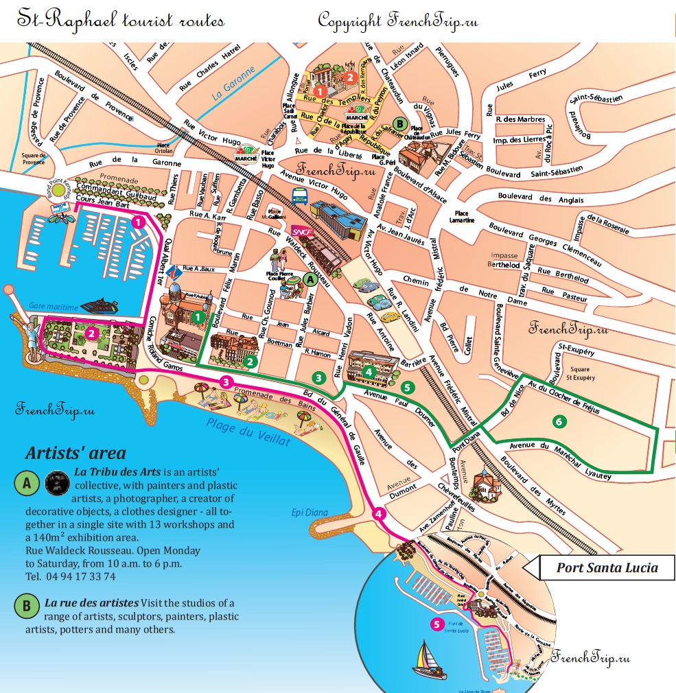
The town marks several signposted routes through the centre, taking in the old quarter, the artists’ district around Rue Waldeck-Rousseau and the port. The map above shows them; the tourist office by the basilica hands out the printed version.
One of the routes threads through the belle-époque quarter: the Hôtel Excelsior, a Palladian villa of 1886 by Pierre Aublé, the architect of Notre-Dame-de-la-Victoire; the Art Nouveau Villa Roquerousse of 1904, its facade worked with flowers and foliage; and Les Palmiers, built in 1882 by the architect Ravel in a mix of Gothic, Renaissance and classical styles typical of the Riviera’s grander buildings. A further loop up on the plateau behind Notre-Dame passes a scatter of villas from the same period, among them Villa Aublé, now a listed monument.
Beaches
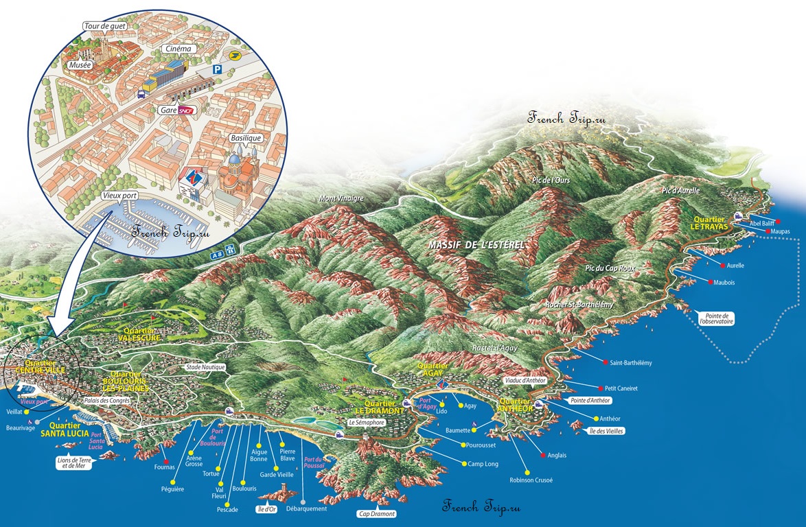
The coast here runs for about 30 km, and the character changes as you go east:
- Plage du Veillat — the town beach, sand, right in the centre and busy
- Beaumont, Aigues-Bonnes, Les Sablettes — smaller sand and shingle beaches spread eastwards
- The Esterel coast — red porphyry rock, small coves and clear water, towards Agay and Le Dramont
- Plage Beau Rivage — a five-minute walk from the centre; despite the name, it is smooth pale-grey pebble rather than sand, and uncomfortable without a towel
- Plage de Saint-Aygulf — the area’s official naturist beach, reached by a marked path through the reed beds west of the fishing village of Saint-Aygulf
The calanques of the Esterel
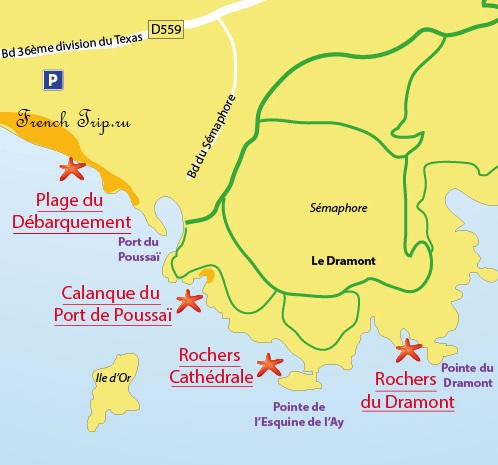
East of the town the Massif de l’Esterel drops straight into the sea in red volcanic rock — the most striking stretch of coastline between Marseille and Italy. The corniche road follows it, with dozens of small coves below. Le Dramont beach is where the American forces landed in August 1944; there is a memorial and a view out to the Île d’Or.
In season a boat also runs the length of this coast, from Saint-Raphaël past Agay to Saint-Aygulf and back, a round trip of a little over an hour with no stops — a way to see the calanques without driving the corniche.
See also the best beaches in the region.
Fréjus, next door
Three minutes by train, and a completely different town: Forum Julii was founded by Julius Caesar, and Fréjus has the remains to show for it — an amphitheatre, an aqueduct, a theatre, and one of the oldest baptisteries in France, from the fifth century, beside the cathedral cloister.
If Saint-Raphaël is where you swim, Fréjus is where you go when it rains.
What to eat
Fish from the port, and the standard Provençal repertoire — bouillabaisse, aïoli, tapenade — at prices noticeably below Saint-Tropez across the water. The morning market on Place Victor Hugo is the good one. More in Provençal cuisine.
The everyday wine of the coast is Côtes de Provence rosé; see Provençal wines. Beyond the produce market, there is a flea market at Place Coullet on Tuesdays and a craft market at the Old Port on Sundays.
Around Saint-Raphaël
- Saint-Tropez — by boat in season, and much the best way; see the guide
- The Esterel — hiking trails through the red massif, with views down the whole coast
- Cannes — 25 minutes by train
- Gorges du Verdon — about two hours inland; see the gorge
- Sainte-Maxime and Port Grimaud — around the gulf; see Port Grimaud
Festivals
A jazz festival runs for three days in early July. In mid-August the Festival St-Pierre des Pêcheurs honours the fishermen who fed the town for most of its history, with a night of fireworks, a short procession from the old church in medieval dress, music and dancing on a wooden stage built for the occasion behind the port, and mock naval battles — joutes — between rival boat crews. See festivals in Provence.
When to go
The season runs from May to October. July and August are busy and the beaches fill, though never to Saint-Tropez levels. May, June and September are the best months. The mild winter that made the town’s reputation still holds — it is a reasonable place to be in February, when much of the coast has closed.
Where to park in Saint-Raphaël
| Car park | Spaces | Fee | From centre |
|---|---|---|---|
| Parking Victor Hugo underground | 150 | paid | 170 m |
| Parking Lamartine underground | 64 | paid | 250 m |
| Parking Cagnat multi-storey | 287 | paid | 260 m |
| Parking de la gare S.N.C.F rooftop | 384 | paid | 310 m |
| Open car park | 30 | free | 440 m |
| Parking Bonaparte underground | 844 | paid | 540 m |
| Place du Club Nautique | — | — | 1.0 km |
| Place des Commerces | — | free | 1.4 km |
Nearby
Other places on this site within easy reach, as the crow flies:
- Roquebrune-sur-Argens — 11 km
- Sainte-Maxime — 17 km
- Fayence — 23 km
- Gassin — 26 km
- Ramatuelle — 27 km
- Mouans-Sartoux — 27 km
Weather in Saint-Raphaël
| Month | Day | Night | Rainfall |
|---|---|---|---|
| January | +13° | +4° | 70 mm |
| February | +14° | +4° | 52 mm |
| March | +16° | +6° | 50 mm |
| April | +19° | +9° | 70 mm |
| May | +22° | +13° | 44 mm |
| June | +26° | +16° | 32 mm |
| July | +29° | +19° | 16 mm |
| August | +29° | +19° | 27 mm |
| September | +26° | +15° | 81 mm |
| October | +22° | +12° | 116 mm |
| November | +17° | +8° | 132 mm |
| December | +14° | +5° | 97 mm |
This page in Russian: Saint-Raphaël (Сен-Рафаэль)
Updated: