Grands Sites de France
Grand Site de France is a state label given to landscapes of national importance that were being damaged by their own popularity, and have been repaired. There are around twenty-five of them, with more in preparation.
It is a more useful list than most for a traveller, because it selects for a specific thing: places worth seeing that have been fixed — car parks moved out of the view, paths rebuilt, coach traffic redirected, vegetation restored. A label is granted for six years and can be withdrawn.
How it differs from UNESCO
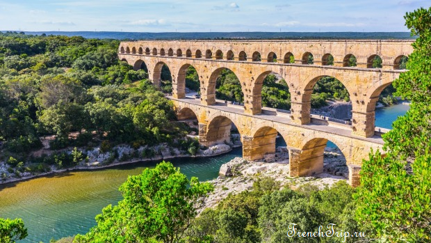
A UNESCO listing is about universal value and is effectively permanent. A Grand Site label is about management: it is awarded to the body running the site, not the site itself, and it is reviewed. Some places hold both — the Pont du Gard and the Bay of Somme among them.
The sites
Coast
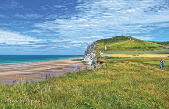
- Deux-Caps — Cap Blanc-Nez and Cap Gris-Nez on the Channel, chalk cliffs with England visible across the strait
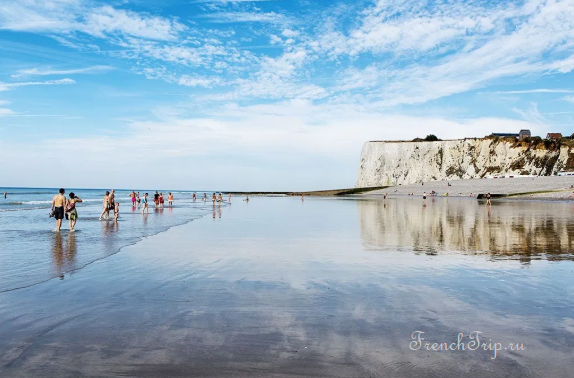
- Baie de Somme — the estuary north of Dieppe, with seals, migrating birds and enormous skies
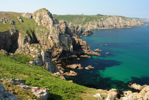
- Pointe du Raz en Cap-Sizun — the western tip of Brittany, and the textbook case: a car park and shops were demolished from the headland in the 1990s and the heath replanted
- Dune du Pilat — the largest sand dune in Europe, at Arcachon
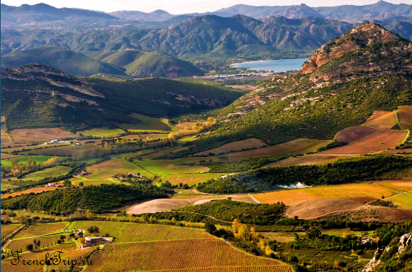
- Conca d’Oru — the vineyards of Patrimonio above the gulf of Saint-Florent in Corsica
- Dunes sauvages de Gâvres à Quiberon — the protected wild coast along the west side of the Quiberon peninsula in southern Brittany, classified since 1936
- Îles Sanguinaires — four dark, porphyry islets at the mouth of the Gulf of Ajaccio in Corsica, the largest carrying a lighthouse built in 1870; Pointe de la Parata on the facing shore belongs to the same site
Deux-Caps takes its name from Cap Gris-Nez and Cap Blanc-Nez, the two headlands of the French coast closest to England; it forms the heart of the Caps et Marais d’Opale regional park and draws around 2.5 million visitors a year, one of the most visited sites in the north of France. The Baie de Somme lies in Picardy, where six rivers — chiefly the Somme — reach the Channel across some 72 square kilometres of tidal flat; a historic steam railway, the Chemin de Fer de la Baie de Somme, still links the towns around the bay, among them Saint-Valery-sur-Somme, Le Crotoy and Cayeux-sur-Mer. Pointe du Raz — Beg ar Raz in Breton — is a granite headland about 72 m high looking out over the Raz de Sein near the village of Plogoff; it received the Grand Site label in 2010. Conca d’Oru was labelled in 2017, the seventeenth site on the list and the second in Corsica; it covers close to 6,000 ha around Patrimonio, in the district known since antiquity as the Conca d’Oro, and overlaps Saint-Florent and the Cap Corse marine nature park.
Mountain and gorge
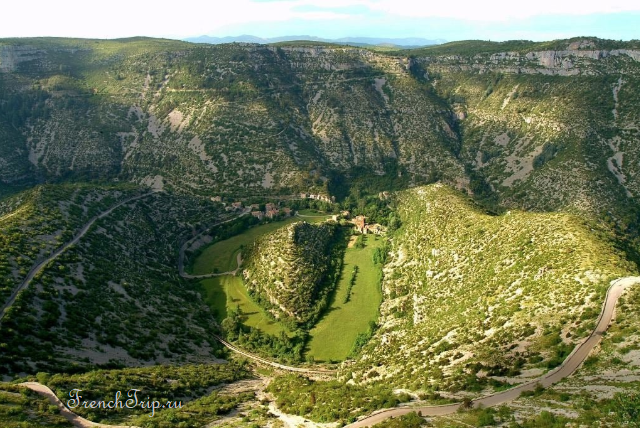
- Cirque de Navacelles — an abandoned river meander cut 300 m into the limestone causse, with a village at the bottom
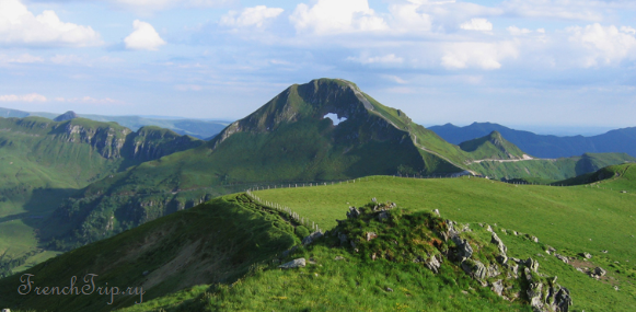
- Puy Mary — the volcanic summit at the centre of the Cantal, and the largest stratovolcano in Europe
- Puy de Dôme — the Auvergne volcano with a rack railway to the top
- Gorges de l’Hérault, with Saint-Guilhem-le-Désert at their mouth
- Massif du Canigó — the sacred mountain of the Catalans, in the eastern Pyrenees
- Sainte-Victoire — Cézanne’s mountain above Aix
- Aven d’Orgnac — a show cave on the limestone plateau south of the Ardèche gorges, notable for the size of its chambers; the excavations at Orgnac III are among the oldest known archaeological sites
At Navacelles, the belvederes of Baume-Auriol and Blandas look down into the amphitheatre carved by a meander of the river Vis, and the site has been protected since 1943. Canigó reaches 2,784 m in the department around Perpignan; visible across Catalonia and occasionally as far as Marseille, it was widely believed until the 19th century to be the highest summit in the Pyrenees, and it divides the historic Catalan regions of Conflent and Vallespir. Puy de Dôme stands about 15 km from Clermont-Ferrand and was treated as a sacred summit by both Gauls and Romans. Puy Mary reaches 1,783 m and was labelled in 2012; it is the eroded remnant of a volcano around 6.5 million years old, shaped into its pyramidal form by successive glaciations, and is usually climbed from the Pas de Peyrol, at 1,589 m the highest road pass in the Massif Central. Sainte-Victoire runs some 18 km between the Bouches-du-Rhône and the Var; its actual high point, the Pic des Mouches, reaches 1,011 m, though the more conspicuous feature is the Croix de Provence, a 19 m cross lower down the ridge.
Wetland and river
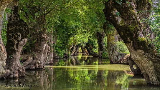
- Marais Poitevin — the “Green Venice” west of Niort: a thousand kilometres of channels under a canopy of trees, seen from a flat-bottomed boat
- Pont du Gard — the Roman aqueduct bridge, where a motor road once ran across the lower tier and the whole approach has since been rebuilt
- Camargue gardoise — the western edge of the Camargue, with Aigues-Mortes
- Vallée de la Vézère — the painted-cave valley of the Dordogne
Marais Poitevin spreads across the Vendée, Deux-Sèvres and Charente-Maritime departments and covers close to 100,000 ha, the second-largest wetland in France after the Camargue; the drier western zone, roughly two-thirds of the total, is used for grazing and farming, while the eastern wet marsh is the maze of tree-lined channels that gives Green Venice its name. Pont du Gard was built to carry water to Nîmes. Camargue gardoise keeps the same white horses, fighting bulls and birdlife as the Camargue delta itself.
Built sites
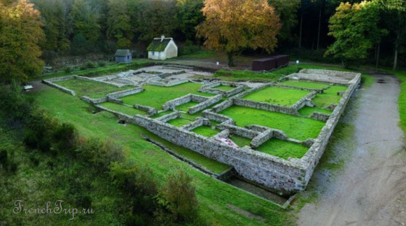
- Bibracte — Mont Beuvray — the Gaulish capital in Burgundy where Vercingetorix was proclaimed leader of the revolt, excavated on a wooded summit
- Rocamadour — the pilgrimage town stacked up a cliff in the Lot
- Solutré, Pouilly, Vergisson — the limestone rock above the Mâconnais vineyards
- Cité de Carcassonne and Saint-Guilhem — walled and monastic
Bibracte was the oppidum, or hillfort capital, of the Aedui and one of the most important strongholds in Gaul, close to modern Autun. Julius Caesar’s army defeated the Helvetii near Bibracte in 58 BC, and in 52 BC Vercingetorix was proclaimed leader of the Gallic coalition at Bibracte itself. It was abandoned within a few decades of the Roman conquest in favour of Autun, and lay undisturbed until archaeologists began excavating it. Solutré is a limestone escarpment above the Mâconnais vineyards near Mâcon; it gives its name to the Solutrean Paleolithic culture, has traces of human presence going back at least 55,000 years, and is considered the historic heart of the Pouilly-Fuissé wine appellation. It drew wide attention in the 1980s, when President François Mitterrand’s yearly climb to the summit became a fixture of the news.
Why the label is useful when planning
- Access has been thought about. Most of these sites now have a park-and-walk or shuttle arrangement rather than a car park in the middle of the view — expect to leave the car further away than you would like, and understand why.
- They are managed for numbers. Several run timed entry or seasonal restrictions in July and August.
- They are not all famous. Bibracte, Navacelles, the Marais Poitevin and Puy Mary get a fraction of the visitors of the Pont du Gard, and are no less worth the day.
See also
This page in Russian: Grands Sites de France — главные достопримечательности Франции
Updated: