Étretat
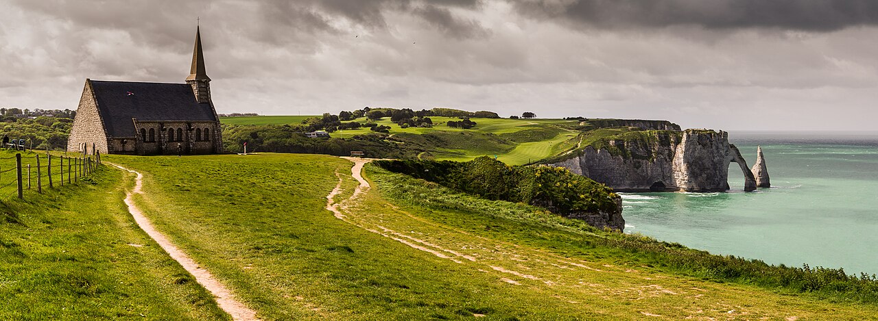
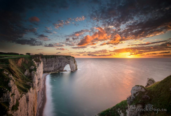
Étretat is a small seaside resort of about 1,200 people on the Alabaster Coast of Normandy, and the reason people come is the shoreline: white chalk cliffs up to 90 metres high, worn by the Channel into natural arches and a free-standing stack called the Needle. It is one of the most photographed stretches of coast in France, and the cliffs look different at every hour and every state of the tide.
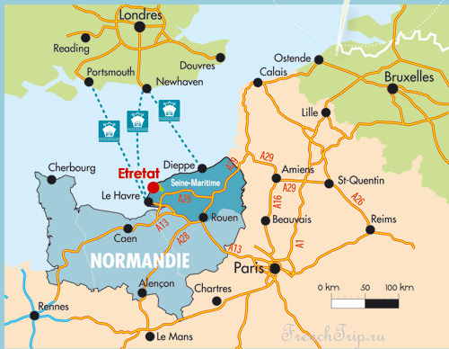
It lies 30 km north of Le Havre and about 200 km from Paris, which makes it a long day trip or an easy overnight stop.
The cliffs and the three arches
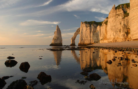
The village sits in a dip in the middle of a pebble beach, with a cliff at each end. Three arches are the famous ones. The Porte d’Aval and the Needle beside it close the west end of the beach; the Porte d’Amont is at the east end; and the largest, the Manneporte, sits further along the western cliff and cannot be seen from the town at all. You have to walk to it. Maupassant said a full-rigged ship could sail through it.
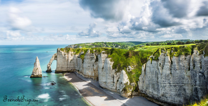
A coastal path, part of the long-distance GR 21, runs along both cliffs. The climb from the beach to the top is steep and in places is a staircase, roughly the height of a nine-storey building, and it is open to the wind with almost no shade. Allow a full day if you want to walk both cliffs and see the village.
Tides and cliff safety
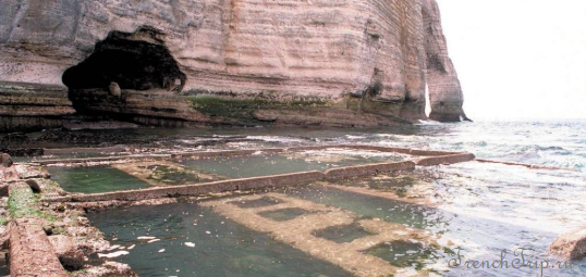
- Check the tide table before going down to the foot of the cliffs. The beach under the western cliff, including the approach to the Manneporte and the cave called the Trou à l’Homme, can only be reached around low tide, and the rising water cuts it off. People are caught out here every summer.
- Chalk cliffs fall without warning. Stay out from under the face, and keep behind the barriers and signs at the top, which are there because the edge is not where it looks.
- It is often cold and windy at the top even on a warm day in the village. Bring a layer, and shoes with a grip.
What to see in the village
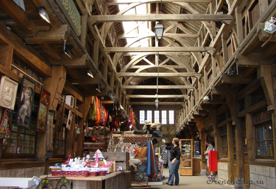
The market hall. The old square has a timber-framed covered market, now full of small shops and stalls. A plaque records the British and American troops who passed through in the Second World War; in the First World War the town had a British military hospital.
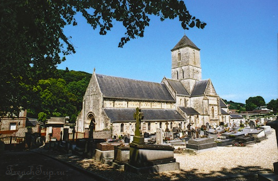
Notre-Dame church. A medieval Norman church that mixes Romanesque and Gothic work, on the far side of the village from the beach.
Le Clos Lupin. The house of Maurice Leblanc, who created the gentleman burglar Arsène Lupin. His novel The Hollow Needle (1909) is set in Étretat, and the Needle is where the plot ends up. The house is a small museum, with material for English-speaking visitors.
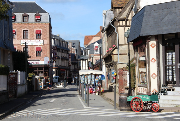
Maupassant. The writer spent much of his childhood in Étretat and built a villa here in 1883, La Guillette, in the street that now carries his name.
On the eastern cliff
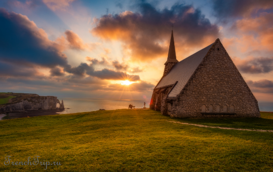
The chapel of Notre-Dame de la Garde was built by sailors in the 19th century, destroyed in the Second World War, and rebuilt in the 1950s. Next to it is a memorial to Charles Nungesser and François Coli, the two French airmen who left Paris on 8 May 1927 in a biplane called L’Oiseau Blanc to try the first non-stop flight to New York. They were last seen near this coast and were never found; what happened to the aircraft remains one of the unsolved mysteries of aviation.
The cliff top also has the Jardins d’Étretat, a garden redesigned in 2017 by the Russian landscape architect Alexandre Grivko, and on the western side the Golf d’Étretat, laid out in 1908 on the clifftop, one of the most spectacular courses in northern France.
The painters
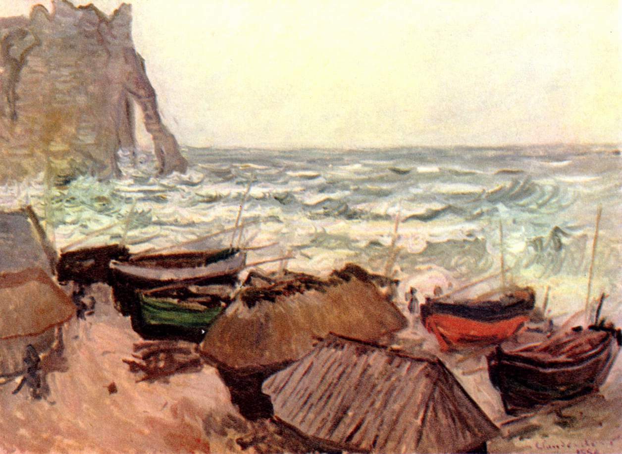
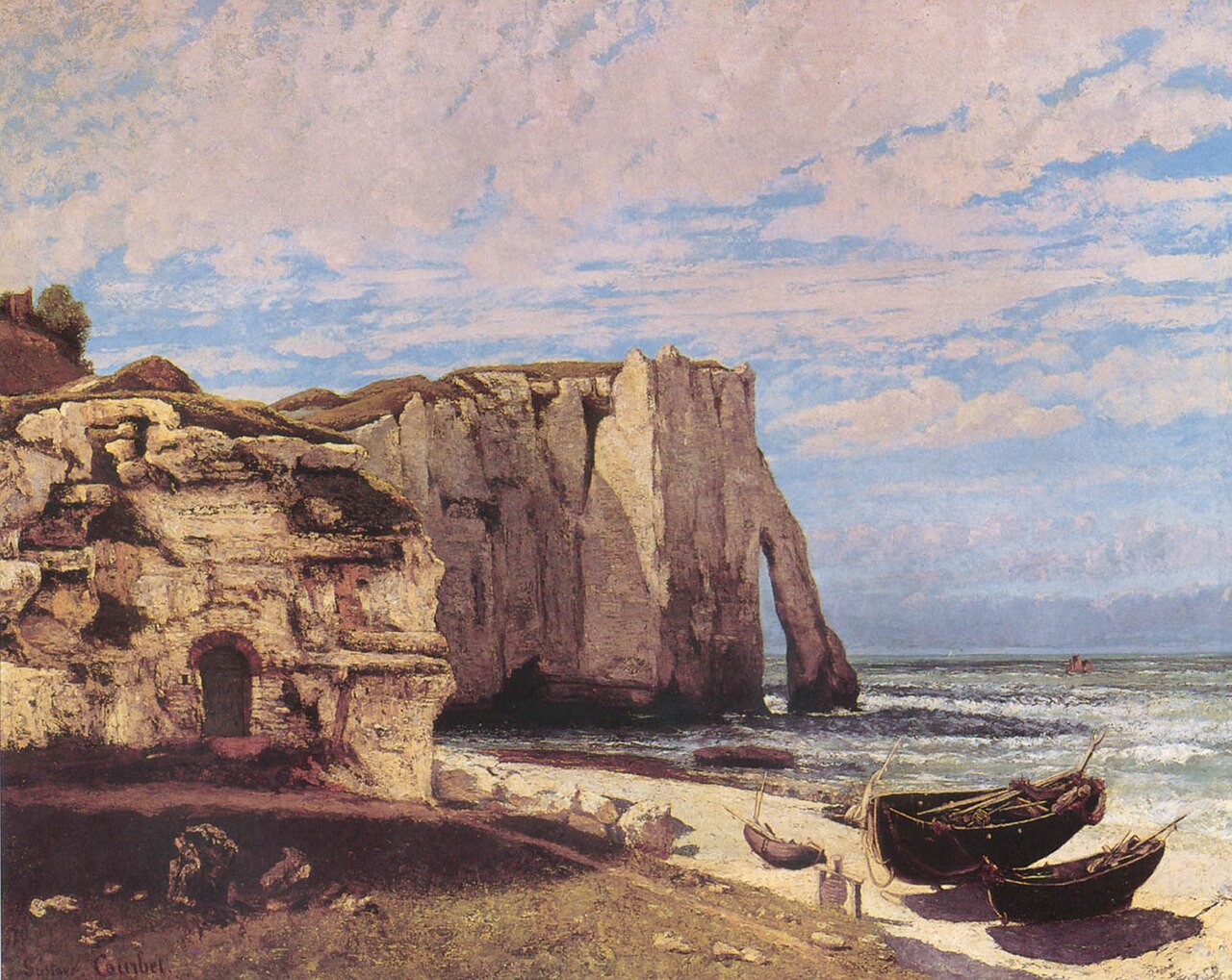
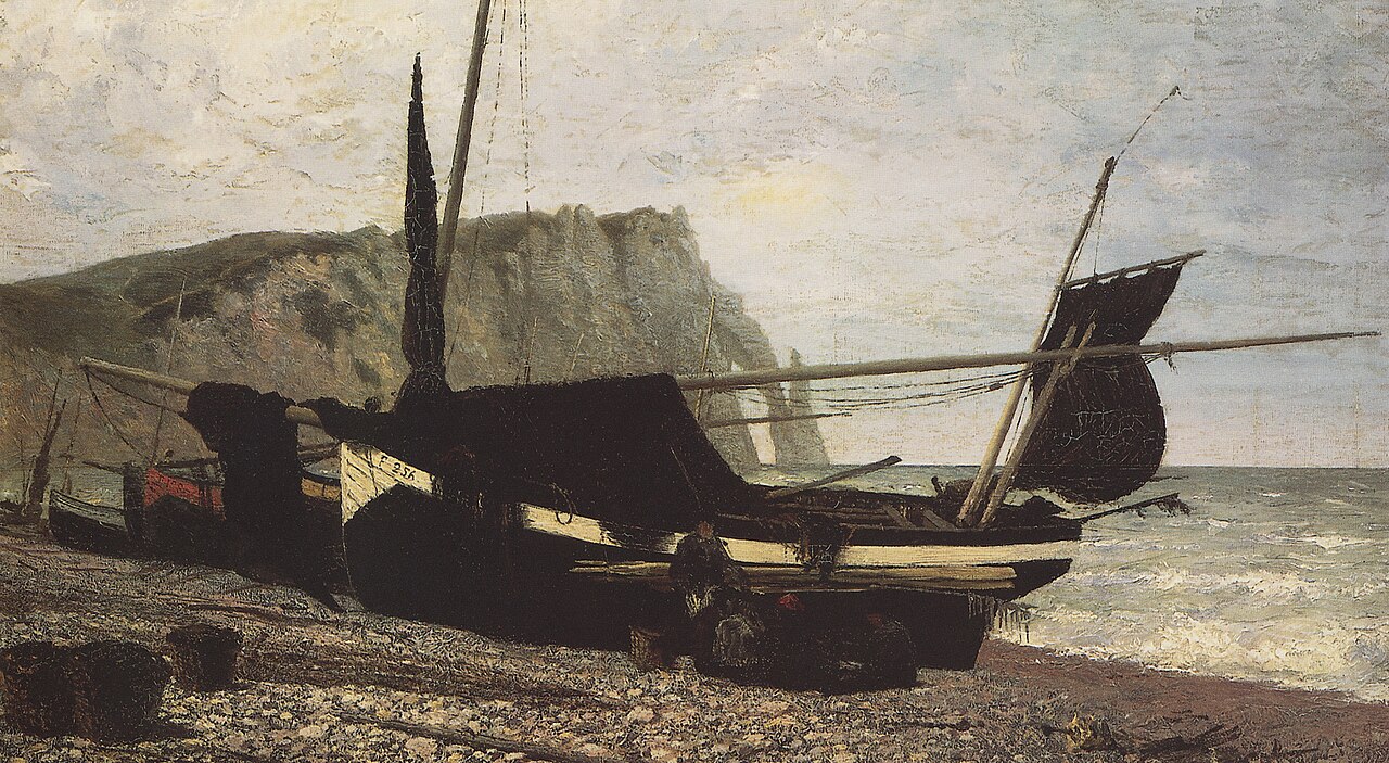
The light and the arches drew painters long before they drew tourists. Gustave Courbet painted the cliffs after a storm in 1869–70, and Claude Monet came back to them again and again through the 1880s; the Russian painter Vasily Polenov also worked here. Some of the places they painted can still be recognised from the coast path. For the wider story of the Normandy coast and the Impressionists, see our Normandy guide.
Getting there
By car is by far the easiest way. From Paris it is about 200 km and two and a half hours: take the A13 towards Rouen and Le Havre and follow the signs for Étretat. From Rouen it is about 106 km (1h20). Some of the motorway sections have tolls; see our guide to toll roads in France.
Parking. There are pay car parks in the centre, close to the beach, and they are full by late morning from spring to autumn. The reliable option is the large car park on the road as you enter the village, a five-minute walk from the centre, and it is a paid one. More on the rules in our guide to parking in France.
Where to park in Étretat
| Car park | Spaces | Fee | From centre |
|---|---|---|---|
| Place du Marché | — | paidmax 5 h | 40 m |
| Place de Gaulle | — | paid | 110 m |
| Place de la Mairie | — | paid | 180 m |
| Parking du Grand Val | — | paid | 530 m |
| Parking de Fréfossé | — | paid | 570 m |
| Open car park | 44 | paid | 620 m |
| Parking de la Gare | — | paid | 900 m |
| Parking de la Guézanne | — | free | 1.5 km |
By train. There is no station in Étretat. The nearest large station is Le Havre, with regular trains from Paris and Rouen; from there you continue by regional bus (the services to Étretat are not frequent, and the timetable changes, so check it before you rely on it) or by taxi. Fécamp, 16 km along the coast, is the other bus connection.
By air. The nearest airports are Le Havre and Deauville; most visitors fly into Paris.
On foot. The village itself is small: from the edge-of-town car park to the beach is five to seven minutes, mostly downhill. A pushchair can manage the village and the promenade, but not the cliff paths.
Tourist office
The tourist office is on Place Maurice Guillard, in the centre, near the bus stop and a few blocks from the beach. Opening hours change with the season, so check before you go.
With children
The cliff walk is a good outing for older children, but a hard one for small ones: the path to the arches is open and exposed, partly stepped, and not suitable for a pushchair. Toddlers will not manage it on foot, and carrying a small child uphill in the sun is tiring. A kinder plan with young children is the pebble beach and the seafront, where the old fishing boats still lie on the stones, and to look at the cliffs from below.
Day trips from Étretat
Distances are approximate, by road:
- Fécamp — 16 km. A fishing port with a large abbey church and the Palais Bénédictine, where Bénédictine liqueur is made.
- Le Havre — 30 km. The port city rebuilt after 1945, a UNESCO World Heritage Site for its postwar architecture.
- Honfleur — 45 km. A small harbour town loved by the Impressionists.
- Rouen — 106 km. The historic capital of Normandy, with its Gothic cathedral and the square where Joan of Arc was burned.
- Giverny — 140 km. Monet’s house and garden.
- Bayeux — 143 km. The Tapestry and the Normandy landings museum.
- Mont-Saint-Michel — about 240 km. A long day, but possible by car; the oyster port of Cancale is on the same bay.
Normandy is also known for its food: apples, cider, Camembert, and seafood. See the cuisine of Normandy.
Weather in Étretat
| Month | Day | Night | Rainfall |
|---|---|---|---|
| January | +8° | +4° | 75 mm |
| February | +8° | +4° | 63 mm |
| March | +10° | +6° | 56 mm |
| April | +13° | +7° | 53 mm |
| May | +15° | +10° | 57 mm |
| June | +18° | +13° | 54 mm |
| July | +20° | +15° | 56 mm |
| August | +21° | +16° | 59 mm |
| September | +19° | +14° | 64 mm |
| October | +16° | +11° | 86 mm |
| November | +12° | +8° | 92 mm |
| December | +9° | +5° | 102 mm |
Photo credits
The photograph at the top of the page is by Benh LIEU SONG, CC BY-SA 4.0, via Wikimedia Commons. The paintings by Monet, Courbet and Polenov are in the public domain.
Updated: