Le Lavandou
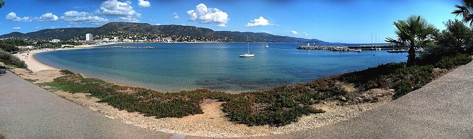
Le Lavandou is a resort of about 6,000 people on the Var coast between Hyères and Saint-Tropez, at the foot of the Massif des Maures. It advertises twelve beaches in twelve kilometres, and unusually for this coast most of them are sand.
It is the mainland departure point for Port-Cros and the Îles d’Hyères, and it is considerably cheaper and less self-regarding than Saint-Tropez round the corner.
The beaches
Twelve of them, running west to east, and they are genuinely different from one another:
- Saint-Clair — the largest, fine sand, family beach with everything behind it
- La Fossette — a small sheltered cove between rocks, and the prettiest
- Aiguebelle — sand, shallow, good with small children
- Cavalière — long, with watersports and beach clubs
- Grande Plage — the town beach, right on the front
- Le Rossignol, L’Éléphant, Jean Blanc — the small coves in between, rock and shingle, quieter
See the best beaches in the region.
The town
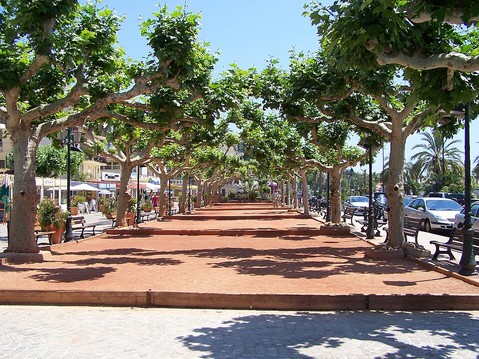
A working fishing port that became a resort in the 1920s, and it still has both: the harbour with its boats and a promenade of plane trees, a Thursday market, and streets of low ochre buildings. It is not picturesque in the way a hill village is, and nobody pretends otherwise — you come for the water.
The name has nothing to do with lavender, despite what every souvenir shop implies. It probably comes from a Provençal word for a wash-house, lavadou.
The boats
Services run from the harbour, April to October, to:
- Port-Cros — about 35 minutes, the strictly protected national park island
- Porquerolles — longer, and usually easier from La Tour Fondue
- Île du Levant — the third island, half military and half naturist
Crossings are cancelled in strong wind, which on this coast means the mistral. Check the day before.
Behind the town
The Massif des Maures rises immediately inland: cork oak, chestnut and pine, with walking and cycling routes and almost nobody on them. The Corniche des Maures, the coast road east towards Cavalaire, runs above the coves and is one of the better drives in the Var.
Bormes-les-Mimosas, 4 km inland and part of the same commune historically, is the hill village Le Lavandou is not — flowered, medieval, and the start of the mimosa route that flowers in February.
Getting to Le Lavandou
- By train — no station. Hyères (25 km) and Toulon (40 km) are the nearest, with buses on from both.
- By bus — regular services along the coast from Hyères and Toulon.
- By car — the coast road from Hyères, or off the A57. In August the corniche is slow and parking near the beaches is difficult from mid-morning. See parking in France.
- By air — Toulon-Hyères is 30 km; Nice is two hours.
Around
- Bormes-les-Mimosas — 4 km, and one of the most flowered villages in France
- Cavalaire and the Corniche des Maures — east along the coast
- Saint-Tropez — 40 km east, and slow in season
- Hyères — 25 km west, with its medieval centre and the salt pans
- Collobrières — in the Maures, and the chestnut capital of Provence
When to go
May, June and September. Le Lavandou fills with French families in July and August rather than with foreign visitors, which gives it a different feel from the rest of the coast — busier in a domestic way, and better value. The water is warmest in September.
Photo credits
Photographs on this page come from Wikimedia Commons under free licences:
- General view — Béotien lambda, CC BY-SA 3.0, via Wikimedia Commons
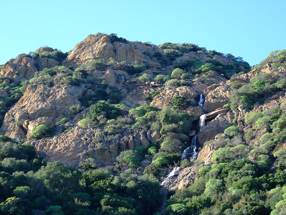
- The Saint-Clair waterfall — Gnrc, CC BY 4.0, via Wikimedia Commons
- The promenade — Wolf Meusel, public domain, via Wikimedia Commons


Nearby
Other places on this site within easy reach, as the crow flies:
- Bormes-les-Mimosas — 3 km
- Hyères — 20 km
- Gassin — 20 km
- Ramatuelle — 21 km
- Port Grimaud — 23 km
- Sainte-Maxime — 29 km
Weather in Le Lavandou
| Month | Day | Night | Rainfall |
|---|---|---|---|
| January | +14° | +3° | 96 mm |
| February | +15° | +3° | 76 mm |
| March | +17° | +5° | 70 mm |
| April | +20° | +8° | 82 mm |
| May | +24° | +11° | 59 mm |
| June | +29° | +14° | 32 mm |
| July | +32° | +17° | 14 mm |
| August | +32° | +17° | 21 mm |
| September | +28° | +13° | 74 mm |
| October | +23° | +11° | 136 mm |
| November | +17° | +7° | 178 mm |
| December | +14° | +4° | 121 mm |
Updated: