Sault
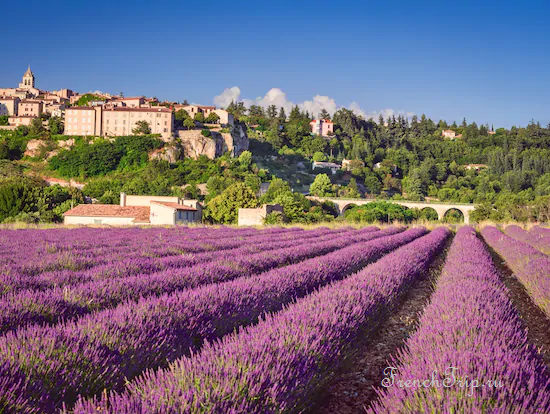
Sault is a village of about 1,300 people on a ridge above a plateau at 800 m, on the eastern side of Mont Ventoux. It is the capital of true lavender — the fine kind grown high, distilled for perfume — as against the lavandin of the lower plateaux.
The practical consequence is the reason to come: Sault flowers two to four weeks later than Valensole, from mid-July to mid-August. If you can only travel in late July, this is where the lavender still is.
History
Sault is first recorded in 859, under the name Saltus — Latin for wooded, wild, uncultivated land. From the eleventh century the barony belonged to the House of Agoult, one of Provence’s great noble families. In 1561 Charles IX raised it to a county for François d’Agoult, then governor of the Lyonnais; his son succeeded him as second Count of Sault, and when he died in 1586 his widow, Chrétienne d’Agerre, became one of the most powerful widows in Provence. She was buried in 1611 in the parish church alongside her husband and children.
In 1575, during the Wars of Religion, Protestant forces from Forcalquier tried to storm the town and failed. The canton of Sault belonged to the old province of Basses-Alpes until 1793, when it was folded into the newly created department of Vaucluse.
During the Second World War the area was an active centre of the Resistance. In reprisal, German forces destroyed houses and arrested residents, some of whom were deported; a war memorial at the foot of the town commemorates them.
The lavender
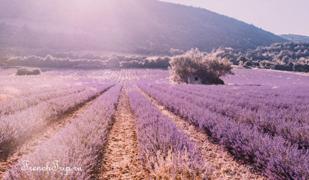
The fields here are smaller than at Valensole and mixed with wheat and spelt, which gives a different picture: purple against gold rather than purple to the horizon. The altitude is what makes it true lavender — lavande fine grows above 800 m and cannot be cultivated lower down.
The Fête de la Lavande on 15 August is the village’s day: a scything competition, distilling demonstrations and a procession. Distilleries around the plateau open through the season and are the interesting half of the subject.
See lavender in Provence for the full flowering calendar.
True lavender, Lavandula officinalis, grows above 800 m and is what covers the Sault plateau; lavandin, a lower-altitude hybrid with spike lavender grown between 200 and 800 m, is showier and higher-yielding but has a coarser scent, and goes into household products rather than perfume. Demand for the crop grew in the nineteenth century with the rise of the perfume industry at Grasse, prompting farmers to start cultivating it; before that it was gathered wild by shepherds on the heights of Mont Ventoux and the Plateau d’Albion.
The marked Chemin des Lavandes is a circular walk of around 5 km through the fields, an easy hour and a half. Several distilleries around the plateau, among them Aroma’Plantes, Vallon des Lavandes and Loge aux Lavandes, open for tours in season. Sault is also a stop on the routes de la Lavande, a signed touring route through the lavender-growing towns of the region, and a second, smaller lavender festival is held on the first Sunday of July in Ferrassières, a village on the Plateau d’Albion about 10 km away.
The village
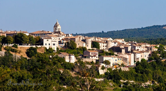
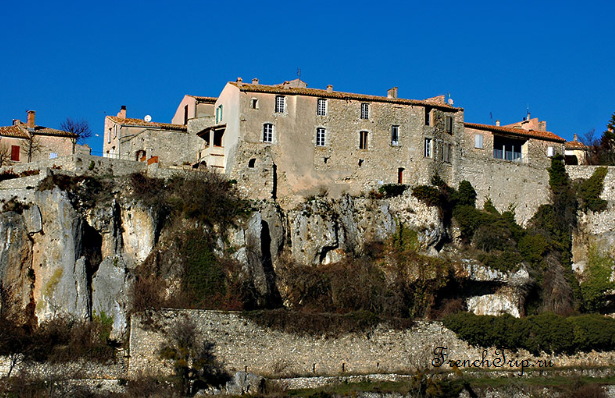
Sault sits along a rock spur with the plateau on one side and the Nesque gorge falling away on the other. It is a working village rather than a restored one.
From the centre there is a wide view over the plateau: a patchwork of cereal and lavender fields, grazed by sheep in spring and summer.
- Église Notre-Dame-de-la-Tour — twelfth-century Romanesque with a fortified look
- Château des Agoult — the remains of the lords’ castle at the end of the spur
- The belvedere — the terrace at the tip, with the whole plateau and Ventoux in front of you
- The Wednesday market, running since 1515
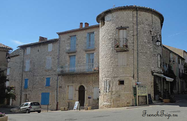
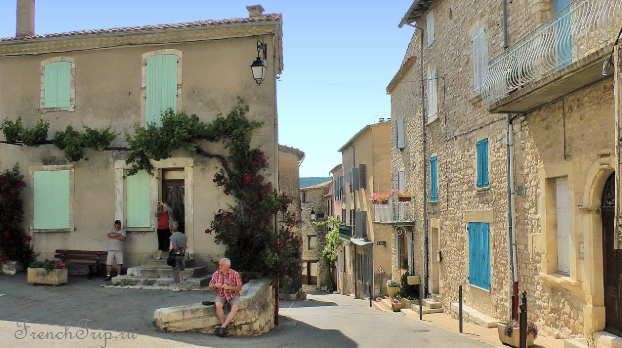
Around the streets and squares are a number of sixteenth-century stone houses, some with decorative doors, windows and ground-floor balconies. A local style peculiar to the region, the maison en hauteur (“house in height”), keeps animals on the ground floor and people above; most were built in the sixteenth century, when the Wars of Religion pushed people to crowd inside the walls for safety, and the type is found mostly in villages. Once the fighting ended and there was no more need to huddle for defence, building spread down into the valley in wider houses. The tall houses have narrow, sparsely-windowed facades of four or five storeys, with terraces or balconies once used for drying fruit and vegetables.
A second, grander style, the maison à tour, belonged to noble families and survived long after the Renaissance: an isolated house, with or without a courtyard, flanked by two towers or defended by four corner towers in the manner of a small castellum. The Château des Agoult is recognisable by its large round corner towers; most of it is now private housing.
Construction of the Église Notre-Dame-de-la-Tour began in the late twelfth century, when it was under the Abbey of Saint-André de Villeneuve-lès-Avignon, and finished in the mid-seventeenth century; it was listed as a historic monument in 1990.
- The ruined fortress of Saint-Jean-de-Durfort, with its watchtower
- Château Saint-Jaume
- A viaduct over the Croc, on the edge of the village
- The fourteenth-century chapelle des Pénitents Blancs, also listed in 1990
- A dolmen known as the Autel du Loup (Altar of the Wolves), in the Défends forest
The municipal museum, open in summer, has an eclectic collection: prehistoric, Gallo-Roman, medieval and mineralogical exhibits, Egyptian pieces including a mummy said to date from the Twentieth Dynasty, weapons from the revolutionary period, paintings by the local painter Évariste de Valernes, and an original edition of Diderot’s Encyclopédie.
Nougat and spelt
Two local products worth buying. Nougat — the plateau has both the lavender honey and the almonds, and Sault has a nougat maker working since 1887 who still boils it in copper.
And petit épeautre, small spelt, an ancient wheat that grows at this altitude where nothing else will. It has IGP status here and it is the grain in every Haute-Provence restaurant.
The nougat is made from whipped egg white, lavender honey and almonds gathered between Ventoux and the Montagne de Lure, and comes in both white and dark versions; the maker offers a free tour of the workshop. Two more local products worth knowing: macarons de Sault and candied fruit, both standard items of Provençal cuisine.
Soap and other crafts
A soap works, Savonnerie en Provence, makes soap by traditional methods and sells cosmetics based on essential oils from its factory shop; it runs demonstrations and workshops in soap and cosmetics making over the summer.
Gorges de la Nesque
The road from Sault west to Villes-sur-Auzon runs 20 km along the rim of a limestone canyon 400 m deep, with a tunnel section and a viewpoint over the Rocher du Cire — a cliff where wild bees have nested for centuries. It is one of the great drives in Provence and it is on the way to Carpentras.
Mont Ventoux
Sault is the start of the easiest of the three roads up Ventoux — 26 km at an average of 5%, against the brutal Bédoin ascent on the other side. Cyclists know this; the Sault side is where you go if you want to reach the summit rather than suffer.
The bare white top at 1,912 m is limestone scree, not snow, and the wind there regularly exceeds 100 km/h. The road over it closes in winter.
Getting to Sault
- By car — the only realistic way. An hour from Avignon, 45 minutes from Carpentras, an hour from Apt. See parking in France.
- By bus — a thin service from Carpentras and Avignon; not usable as a day trip.
- The Carpentras bus runs via Mazan, Mormoiron, Villes-sur-Auzon and Monieux; the Apt bus via Saint-Saturnin-lès-Apt and Rustrel.
Around Sault
- Mont Ventoux — 45 minutes to the summit by road
- Gorges de la Nesque — the canyon road west
- Simiane-la-Rotonde — a hill village 25 km south-east, with a twelfth-century rotunda and its own lavender
- Banon — 30 km, known for goat cheese wrapped in chestnut leaves and an improbably good bookshop
- Forcalquier — 45 minutes south
- Reilhanette, Aurel and Brantes — small hill villages within around 20 km
- Montbrun-les-Bains — a spa town in the same area
- Montagne de Lure — a limestone range near Sault, part of the same corridor of hiking and green tourism as Ventoux and the Nesque gorge
When to go
Mid-July to mid-August for the lavender — this is the one place in Provence where August still works. Otherwise September and October for the plateau in autumn, when the light is long and there is nobody about. Sault is 800 m up: it is noticeably cooler than the Luberon and it can be cold at night even in summer.
Weather in Sault
| Month | Day | Night | Rainfall |
|---|---|---|---|
| January | +8° | -3° | 91 mm |
| February | +9° | -3° | 60 mm |
| March | +12° | -1° | 64 mm |
| April | +15° | +2° | 89 mm |
| May | +19° | +6° | 80 mm |
| June | +24° | +9° | 54 mm |
| July | +27° | +11° | 33 mm |
| August | +27° | +11° | 51 mm |
| September | +22° | +8° | 107 mm |
| October | +17° | +5° | 132 mm |
| November | +11° | +1° | 158 mm |
| December | +8° | -2° | 98 mm |
Updated: