Lavezzi Islands
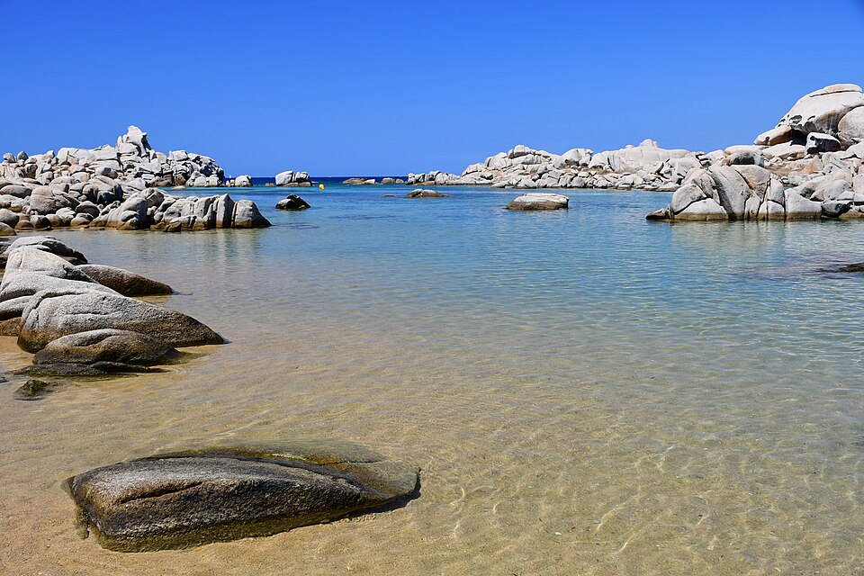
The Lavezzi islands are a scatter of granite islets in the strait between Corsica and Sardinia, 10 km south-east of Bonifacio. They are uninhabited, they are a strict nature reserve, and they have the clearest water in France.
Nothing is built on them. You arrive by boat, you swim, you walk the paths, and you leave on the last boat.
The landscape
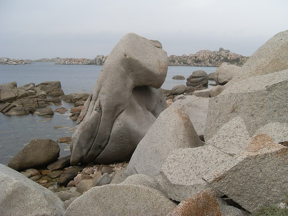
Everything here is granite, rounded and hollowed by the wind into shapes that look deliberately sculpted — the geological term is a tor field, and this is one of the finest in the Mediterranean. Between the boulders are pockets of sand and water so shallow and clear that boats appear to float above the bottom.
The islands lie in the Bouches de Bonifacio nature reserve, created in 1982 and covering some 800 km² of sea. Under the water the seagrass meadows and rock are among the healthiest in the western Mediterranean, which is why snorkelling here is the point rather than an extra.
The Sémillante
The strait is notoriously dangerous, and the islands hold a memorial to how dangerous. On 15 February 1855 the frigate Sémillante, carrying troops to the Crimean War, was driven onto the rocks in a storm. All 773 people on board died — the worst shipwreck in French naval history.
Two cemeteries on the main island hold the dead, walled enclosures of white crosses among the granite. Alphonse Daudet wrote about them in Lettres de mon moulin. They are on the walking route and they change the mood of the place.
What to do
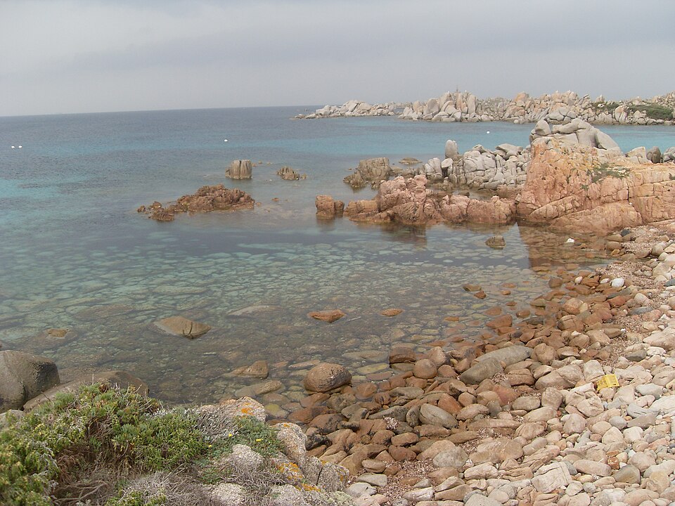
- Swim. Cala di u Grecu, Cala Lazarina and the Achiarina beach are the sheltered ones, all sand between granite.
- Snorkel. The water is shallow and transparent, and there are fish because nothing is taken here.
- Walk. Marked paths cross the main island in about an hour and a half, past the two cemeteries and the lighthouse.
The rules
This is a reserve, not a beach resort, and it is policed:
- Stay on the marked paths
- No camping, no fires, no smoking
- Take nothing — not shells, not stones, not plants
- Carry your rubbish back; there are no bins because there is no one to empty them
- No shade and no water on the island. Bring both, plus a hat. This is the practical warning that matters most.
The boats from Bonifacio
The tourist office in Bonifacio runs two different trips, and it is worth knowing which is which before you queue.
The short one takes an hour: out along the cliffs, into one of the sea caves under the town, and back. Boats leave roughly every twenty minutes in season, and some have glass bottoms. Reckon on about 18€ for an adult and appreciably less for children — check the current board at the harbour.
The Lavezzi trip takes around three hours and includes time ashore on the largest island. It also gives you the one view of Bonifacio you cannot get from land: the whole town leaning out over the white cliff, seen from the water below.
There is nothing on the islands — no café, no shop, no shade to speak of. Take water, food and sun cream, and take your rubbish back with you.
From the mainland the islands are in view from the beaches at the southern tip: Grand Sperone, Petit Sperone and Piantarella, the last of which has the car park. On a clear day the line on the horizon behind them is Sardinia.
Getting there
- By boat from Bonifacio — the standard trip, 30–40 minutes, run by several operators from the marina. Most sail out via the cliffs and the Grotte du Sdragonato, drop you on the island for two or three hours and collect you later. Some are cruise-only and never land: check that yours actually stops.
- From Porto-Vecchio and Santa Giulia — longer day trips in season.
- By private boat — anchoring is restricted and controlled by the reserve.
Boats run roughly April to October and are cancelled in wind, which in this strait is frequent. Book the day before and expect the weather to have a vote.
Around
- Bonifacio — the walled town on white cliffs above the strait, and the departure point
- Cavallo — the neighbouring island, privately owned and unlike Lavezzi in every respect
- Santa Giulia and Palombaggia — the famous beaches of the south-east coast
- Sardinia — visible across the strait, and reachable by ferry from Bonifacio in an hour
When to go
June and September. July and August bring several boatloads an hour to a small island with no shade; the water is warmest in September; and outside the season the boats stop running. Go early in the day if you can — the first departure has the island close to empty.
Photo credits
Photographs on this page come from Wikimedia Commons under free licences:
- Cala du Chiesa — Gzzz, CC BY-SA 4.0, via Wikimedia Commons
- Granite boulders — Alex Riechert, CC BY-SA 3.0, via Wikimedia Commons
- The shoreline — Alex Riechert, CC BY-SA 3.0, via Wikimedia Commons


Nearby
Other places on this site within easy reach, as the crow flies:
Weather in Îles Lavezzi
| Month | Day | Night | Rainfall |
|---|---|---|---|
| January | +14° | +9° | 61 mm |
| February | +14° | +9° | 49 mm |
| March | +15° | +10° | 52 mm |
| April | +18° | +12° | 54 mm |
| May | +21° | +15° | 40 mm |
| June | +25° | +19° | 18 mm |
| July | +28° | +22° | 7 mm |
| August | +29° | +22° | 12 mm |
| September | +26° | +20° | 56 mm |
| October | +22° | +17° | 74 mm |
| November | +18° | +13° | 89 mm |
| December | +15° | +10° | 70 mm |
Updated: