Gorges de Spelunca (Spelunca Gorge)
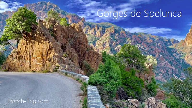
East of Porto, in the western part of Corsica, a scenic road winds through the mountains, leading to Corte. The first 20 kilometers of the route pass through the Gorges de Spelunca, a picturesque river valley through the mountains and an easy way to explore the countryside.
The Gorges de Spelunca spans an area of 263 hectares across the municipalities of Evisa, Ota, and Marignana. It extends upstream from the village of Ota, beginning at the Genoese Pianella Bridge, which crosses the confluence of the Lonca and Porto rivers.
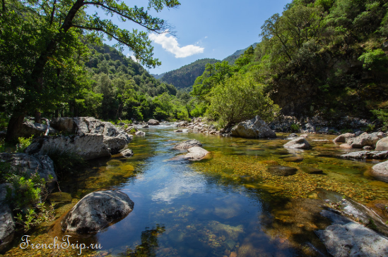
The breathtaking Spelunca Gorge, located inland from Porto, offers fantastic routes for mountain hikes, trekking, and freshwater swimming during hot days. A 45-minute trail, marked with orange signs, leads east through the heart of the canyon from the bridge over the Porto River, 2 km east of Ota on the D124, to the Zaglia Bridge, an 18th-century Genoese stone bridge.
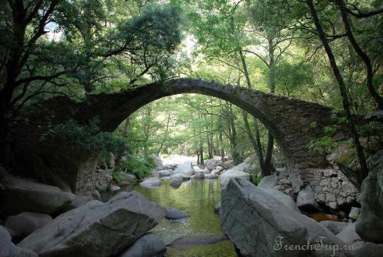
Zaglia Bridge:
For a longer hike, you can take the trail from Ota to Evisa (2.5 hours each way). You can also simply drive to the river and swim there without needing to hike. There are many pools where you can splash around, some deep enough for diving and swimming. On hot summer days, it can get quite crowded, so it’s best to arrive early. There are plenty of suitable spots for both small and large children.
Exploring Spelunca Gorge:
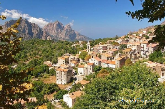
There are various ways to explore the Gorges de Spelunca. The most common route by car starts on the D124, heading towards Ota from Piana, then connects to the D84 road, which leads to Evisa. Although the villages of Ota and Evisa don’t feature major monuments, they are located in striking landscapes with mountains behind them. If time allows, it’s worth visiting both villages; otherwise, Evisa is the more interesting of the two, and both are part of popular hikes in the valley.
Evisa Village with a mountain backdrop:
Routes along the Spelunca Gorge
There are several walking options in the Gorges de Spelunca. You can drive east from Evisa and park at a bend in the road beyond the village, where several trails through the gorge begin. The path leading to the Zaglia Bridge passes through the gorge, offering a variety of landscapes: mountains, river valleys, and pools. It’s an easy trail, and after about 40 minutes, you’ll reach the Ponte a Zaglia, a Genoese bridge built in the late 18th century to ease the lives of locals and shepherds. The bridge has a high arch, as the river overflows and flows rapidly at certain times of the year. Near Ponte à Zaglia, there are peaceful water basins surrounded by boulders, ideal for picnicking and swimming.
Alternative Route:
Another route descends from Evisa to Ota. This is also a very pleasant path but takes about three hours. Ideally, someone could drive the car from Evisa to Ota while the rest of the family enjoys the hike!
Nearby Attractions:
Forest d’Aitone:
The entire road from Evisa to Corte passes through beautiful landscapes and mountains. East of Evisa, the Forest d’Aitone is a very ancient pine forest that attracts many tourists. One of the interesting trails starting a few kilometers east of Evisa leads to the Cascades de la Valla Scarpa, a lovely spot popular with river swimmers. The remoteness of this part of the island has preserved some of the rarest wildlife species, including the red snake, Corsican nuthatch, and the elusive Corsican wildcat. From the road, there are paths leading to several stone pools and small waterfalls.
Aitone Waterfall:
You should follow the D84 road towards the Vergio pass (the waterfalls are located between Evisa and the summit of Vergio). As you leave Evisa, turn left at the stop sign towards Aïtone and continue for about 3 kilometers. When you see a large iron sign on the lower left, the path to the waterfalls and Aitone’s natural pools is just ahead on the left. The trailhead to the waterfalls is at the road’s edge. Take this easy access route and walk for 10-15 minutes until you see a stone staircase on the left. Climb it, and you’ll arrive at the waterfall.
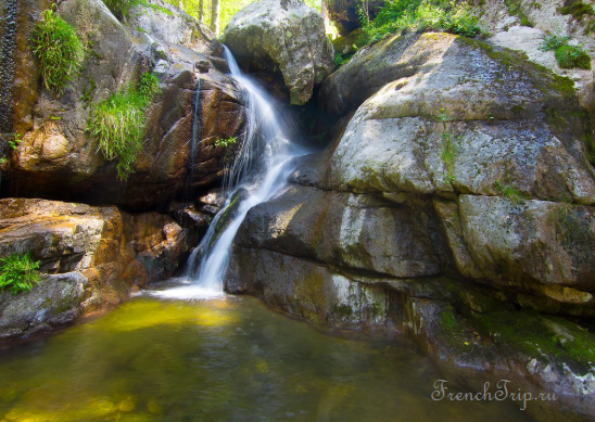
Cascade De Radule:
The Radule waterfalls and sheepfolds are in a stunning location, with the option of swimming in the waterfall.
- Starting point: after the Vergio pass, on the D84 towards Albertacce (you will pass in front of the Castel de Vergio hotel) in a large bend at a spot called “Le fer à cheval.”
- Duration: about 2 hours.
- Elevation: 160 meters.
- Difficulty: a partially shaded trail marked in blue; suitable footwear is recommended.
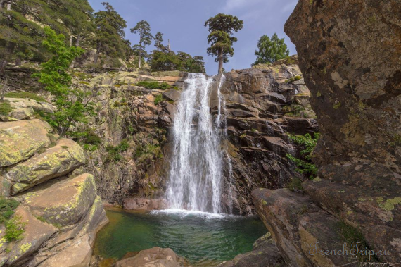
Calanques de Piana:
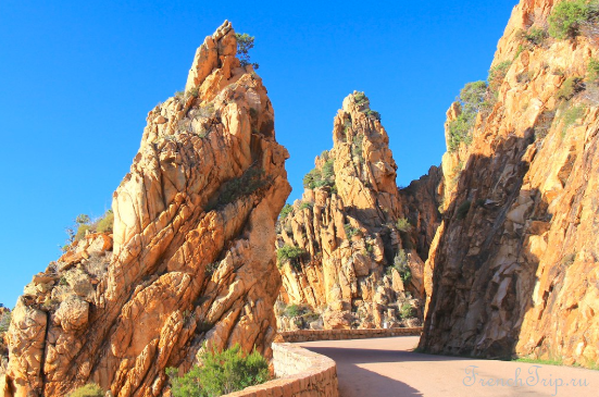
The red cliffs of the Calanques de Piana, south of Porto, are one of the most scenic places in Corsica. The unique rock formations, creating a surreal landscape with shapes like the “dog’s head” and the “heart,” are listed as a UNESCO World Heritage site. The nearby village of Piana, which gave its name to the reserve, is among the most beautiful villages in France.
Archives
Calendar
| M | T | W | T | F | S | S |
|---|---|---|---|---|---|---|
| 1 | ||||||
| 2 | 3 | 4 | 5 | 6 | 7 | 8 |
| 9 | 10 | 11 | 12 | 13 | 14 | 15 |
| 16 | 17 | 18 | 19 | 20 | 21 | 22 |
| 23 | 24 | 25 | 26 | 27 | 28 | |