Evisa
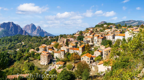
Evisa is a tiny village with just 182 inhabitants, located in the Gulf of Porto on the western side of Corsica. Picturesquely situated on a mountain slope at an altitude of 830 meters, it serves as the gateway to the beautiful Spelunca Gorge, stretching between Evisa and Ota.
In July and August, Evisa thrives with mountain and forest hikes, river swims, and conversations under the linden trees in cafes, parks, and terraces. The village has three hotels, four cafes, and restaurants.
Getting to Evisa
There are infrequent buses from Ajacco and Calvi (to Porto and Ota) to Evisa. Check the schedule and prices on the Porto page.
Since there are at most two routes a day, it’s better to travel to Evisa by rented car, which also allows you to freely explore the Spelunca Gorge.
What to see in Evisa
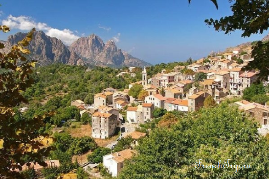
The village of Evisa is built according to a typical Corsican layout and is not particularly interesting architecturally. The local church of Saint Martin is recently constructed. The old church of the pieve Saint Cyprien from the 10th-11th century is located near the current cemetery. However, in the Spelunca Gorge, you can see the 11th-century Zaglia Bridge.
In Evisa, there is also the oratory of Saint Martin and the village fountain from the 12th century, crowned with a statue by sculptor Mariotti in honor of Ferdinand Ceccaldi. A native of Evisa, Fiorello Ceccaldi (born in 1802 and died in 1869) was a general doctor of Emperor Napoleon III’s army. He acquired the Girolata tower and fort in 1866 when the domain administration put them up for sale.
Evisa proudly displays its motto as a mountain village: “Alta tenet evisa.”
Evisa’s Attractions
- Old Pieve Church of Saint Cyprien
- Parish Church of Saint Martin: Built in the 17th century and completed in 1882.
- Memorial to General Fiorello Ceccaldi
- Col de Vergio (in Corsican: Bocca à Verghju) — the highest road pass in Corsica (1478 m)
- Alzu Ritondellu and Fontana di Topu fountains
- Genoese Zaglia Bridge crossing Tavulella stream
- Rural heritage: chamber ovens, mills, coal furnaces, chestnut dryers
Minicale
Born in Evisa in 1868 and died there in 1963, Minicale was renowned throughout Corsica and was part of a generation rich in Corsican poets, essayists, and storytellers. He practiced a poetic form called “Chjami è rispondi” (calls and responses), a type of oral sparring where two poets exchanged improvisations accented by a traditional melody of octosyllabic structure, sometimes for hours. Traveling from fair to fair, Minicale performed this exercise brilliantly, blending humorous allusions into his improvisations that delighted large audiences. The local public remains captivated by this form of poetry, rooted in ancient Mediterranean traditions.
Nearby sights
Mills, a cave where bandits hid, an abandoned village between Evisa and Marignana, Tasso ruins, natural pools and waterfalls, and the Spelunca Gorge.
Col de Vergio
Col de Vergio (in Corsican: Bocca à Verghju) is the highest road pass in Corsica (1478 m). Along with the Vizzavona, Verde, and Bavella passes, it is one of Corsica’s four “great passes” connecting the island’s two sides. The Vergio pass connects the Golo valley with the Porto harbor and, consequently, with the center of Corsica (Centru di Corsica). It lies at the edge between Punta de Criche (2057 m) of the Cinto massif in the north and Capu Rughja (1712 m) of the Rotondo massif in the southeast. Both sides of the pass are forested: the Valdu Niellu and Aïtone forests are among the largest on the island.
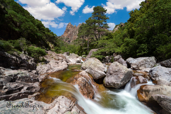
In summer, many foreign cyclists ascend and descend from the Vergio pass to Evisa through the Aïtone forest because the shaded, cool route is not heavily trafficked.
About 1.5 km below the pass, on its eastern slope, in a place called Castellu di Vergio, is the Vergio ski resort. On the other side, down to Evisa, the Aitone resort village (Paesolu d’Aïtone) opens cross-country ski trails in winter.
Cascades d’Aïtone
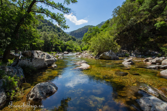
The Aïtone waterfalls are a series of small waterfalls and natural pools carved into the rock, surrounded by trees from the Aïtone forest, giving the area an emerald green color.
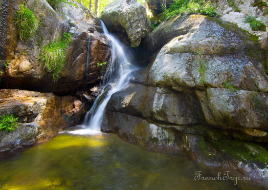
There are several ways to see the Aïtone waterfalls, located west between Evisa and the Vergio pass:
- From Evisa village, take a small, easy hike of 2:30 hours round trip, descending 250 m. Depart from the village bars and follow the Chestnut Grove path to the D84, then take the forest trail leading to the Aïtone waterfalls. The hike can be shortened by starting 1.5 km after Evisa, on the D84 towards Corte, taking just one hour round trip.
- Alternatively, there’s a direct and very easy access to the waterfall from the road, just a ten-minute walk. Park along the road at the Aïtone forest entrance, about 4 kilometers from Evisa on the D84.

Forêt d’Aïtone
The picturesque Aïtone forest is one of the largest in Corsica.

Gorges de Spelunca
The Spelunca Gorge (in Corsican: Spilonca) is located between the villages of Ota and Evisa. The Spelunca Gorge is crossed by the Tavulella stream, fed by the Aïtone stream, with their confluence below the Genoese Zaglia Bridge, after which the river is named Porto.
The gorge offers breathtaking scenery dominated by a massive rock that once held the U Castellu castle, destroyed according to local legend in the 17th century. Read more…
Spilonca Trail
The mule track starts from the D84 road at the western entrance to Evisa at 850 meters altitude. It follows the long hiking trail Tra Mare e Monti, linking Calenzana in the north with Cargèse in the south through Ota and Evisa. It crosses the Zaglia bridge over the Tavulella stream.

The trail ends (Ota side) at a place called “2 bridges,” where the D124 road crosses the Tavulella river and Lonca stream. Parking is available on the roadside. The road gently descends to Ota. From the “2 bridges,” the trail leads to the small village of Ota, crossing another Genoese bridge, the Pianella bridge. The remarkable Ota rock, Capu d’Ota (890 m), is visible from the middle of the trail.
This interpretive trail descends along the Spelunca gorges with tall forests, marked by no less than 25 panels or an alcove explaining the flora, fauna, and construction of the Genoese bridge. It’s primarily an easy cultural walk, which can be complemented with a picnic stop and swimming in the clear, cool river water.
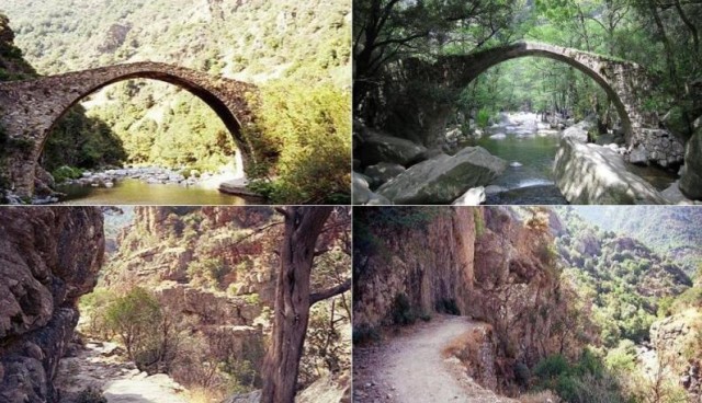
Zaglia Bridge
The Zaglia Bridge, designed in 1712, was built in 1797 by the Genoese stonemason Antonio Bensi to facilitate the movement of shepherds and residents threatened by a land crisis. It exemplifies typical Genoese bridges. The impressive span of the arch is due to the Tavulella’s torrential seasonal flow and its tributaries. Building a bridge like Zaglia takes one or two years. Sometimes, the river’s course must be diverted for dry work, and significant abutment masonry is required. The Genoese bridge is a masterpiece of science, aesthetics, and architectural technique; crossing the river with a single arch, its two “abutments” rest directly on the rocky chaos of the banks.
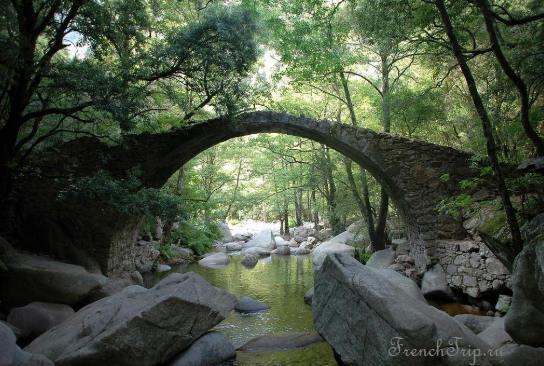
Pianella Bridge
The 15th-century Genoese Pianella Bridge is located on the banks of the Porto river, formed by the confluence of the Tavulella and Lonca streams downstream from the “2 bridges,” at the exit of the Spelunca gorge. The Pianella Bridge was also classified as a historical monument in 1976.

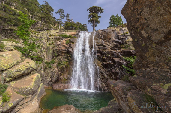
Cascade De Radule
From Evisa, follow the D84 towards Col de Vergio, then continue 3.7 km to reach the turning circle (Fer à Cheval). From there, a hiking trail leads to the Cascade de Radule, a magnificent waterfall!
Evisa on the map:
→ Get back to Corsica travel guide
Archives
Calendar
| M | T | W | T | F | S | S |
|---|---|---|---|---|---|---|
| 1 | ||||||
| 2 | 3 | 4 | 5 | 6 | 7 | 8 |
| 9 | 10 | 11 | 12 | 13 | 14 | 15 |
| 16 | 17 | 18 | 19 | 20 | 21 | 22 |
| 23 | 24 | 25 | 26 | 27 | 28 | |
